At about 4,001 m, the summit of the Oldoinyo Lesatima hike is the highest point in Kenya’s Aberdare Range. Most hikers reach it on a 14-17 km return walk across open moorland, passing the jagged rock towers known as the Dragon’s Teeth. Expect 4-7 hours on foot, an armed KWS escort, cold wind and boggy ground.
Getting there is half the effort: the moorland trailheads sit roughly 170-190 km from Nairobi, high in Aberdare National Park, and the weather up there can turn from sunshine to thick mist within half an hour. Below you will find the route, the gates and roads from Nairobi, the KWS arrangements, the best months, a kit list for the bogs and the summit wind, and how to join our guided Oldoinyo Lesatima hike on Saturday 14 November 2026.

Oldoinyo Lesatima Hike: Quick Facts
- Summit: About 4,001 m, the highest point of the Aberdare Range (also spelt Ol Donyo Lesatima, and called Mt Satima).
- Location: Northern sector of Aberdare National Park, on the Nyandarua side of the range.
- Distance and time: About 14-17 km return over 4-7 hours, depending on where your vehicle stops.
- Climb: Trailheads sit high on the moorland at roughly 3,400-3,600 m, so the ascent is modest; the altitude and bogs are the real test.
- Landmark: The Dragon’s Teeth, a row of jagged volcanic rock pillars on the moorland approach.
- Access: Kenya Wildlife Service park entry and an armed ranger escort from the gate.
- Our next guided date: Saturday 14 November 2026, leaving from Nairobi.
What Is the Oldoinyo Lesatima Hike Like?
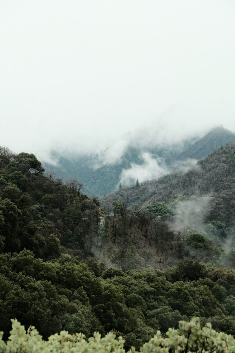
The Oldoinyo Lesatima hike is a high, open moorland walk rather than a steep forest slog. You drive most of the height, then walk over tussock grass, giant heather and bog, between the Dragon’s Teeth, and up a short rocky final climb to a summit marker at about 4,001 m.
That makes the Oldoinyo Lesatima hike a different kind of day from most hikes near Nairobi. On the Ngong Hills or Mt Longonot you feel the climb in your thighs. Up here you feel it in your lungs, your cold fingers and your wet socks. The gradient is mostly gentle, but the ground is spongy and uneven, the air is thin, and the wind across the top of the Aberdares has nothing to stop it.
On a clear morning the reward is huge. From the summit you look out over the Laikipia and Nyeri plains, across to Mt Kenya on the horizon, down to Lake Ol Bolosat on the Nyandarua side, and south along the spine of the range towards the Kinangop. On a misty day you may see none of it, which is why an early start matters so much.
Where is Oldoinyo Lesatima in Kenya?
Oldoinyo Lesatima rises at the northern end of the Aberdare Range, inside Aberdare National Park, above Nyandarua County to the west and Nyeri County to the east. The range itself is known in Kikuyu as Nyandarua. Table Mountain, another popular day hike, lies roughly 8 km to the south across the same moorland.
The name is Maasai, and is usually translated as “mountain of the bull calf”. You will see it spelt several ways on maps and signboards, including Ol Donyo Lesatima, Oldonyo Lesatima and Satima, but they all mean the same 4,000 m peak.
What are the Dragon’s Teeth?
The Dragon’s Teeth are a cluster of sharp, dark rock pillars that stick up out of the moorland on the main approach to the summit. Geologists describe them as hard volcanic rock, mainly trachyte and phonolite, left standing after the softer ground around them wore away.
For most people they are the moment the Oldoinyo Lesatima hike becomes memorable. The path winds between the pillars, mist often drifts through the gaps, and the pinnacles make a natural place to regroup, take photos and add a layer before the final climb. Rock climbers also use them, so do not be surprised to see ropes on a weekend.
Oldoinyo Lesatima Hike Route, Stage by Stage
The Oldoinyo Lesatima hike follows four stages: a high drive through forest to the moorland edge, an open walk over tussocks and heather, the passage through the Dragon’s Teeth, and a short, rocky pull to the summit. The trail is faint in places and follows animal tracks.
Stage 1: The drive up to the moorland
From Shamata Gate on the western side, a dirt road climbs about 11 km through indigenous forest, rising from roughly 2,850 m to 3,450 m before it ends near the forest edge by a pair of hills known as Twin Peaks. A 4WD vehicle is the safe choice here, especially in the rains. From Rhino Gate on the Nyeri side, a similar drive of about 10 km brings you to the same area, where a signboard points towards Satima Peak.
Stage 2: Tussocks, heather and bog
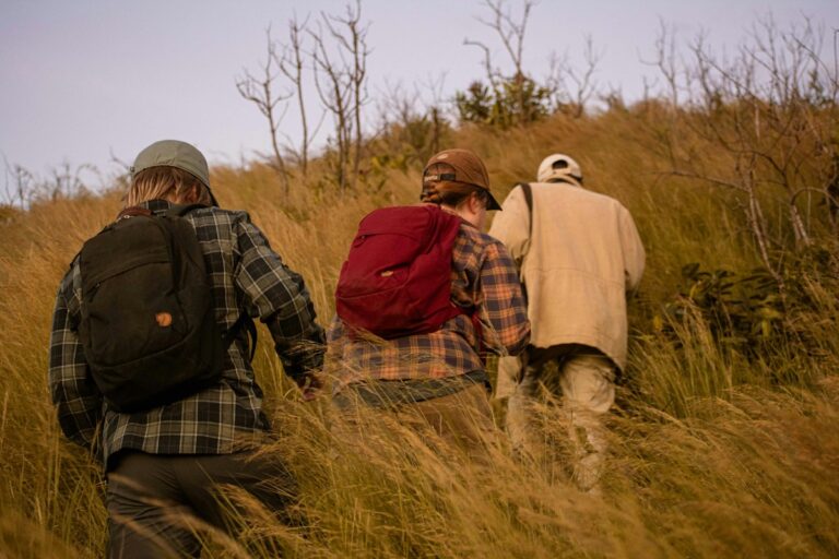
Once you leave the vehicles, the Oldoinyo Lesatima hike crosses open moorland on animal paths. Giant heather grows in thickets, sometimes blackened by old fires, and tussock grass hides pools of water between the clumps. The trick is to step on the tussocks, not between them, and to test soft ground with a trekking pole before trusting it with your weight.
Stage 3: Through the Dragon’s Teeth
On the Oldoinyo Lesatima hike, most groups reach the Dragon’s Teeth after one to two hours of walking from the Twin Peaks area, depending on pace and how wet the ground is. The path threads between the rock towers, and on a breezy day the pinnacles give welcome shelter. Look out for giant groundsels and lobelias, the strange tree-like plants of East Africa’s high mountains.

Stage 4: The summit push and the way down
Beyond the Dragon’s Teeth the route climbs a series of ridges, then finishes with a short, steeper and rockier section to the summit marker. This is the part where the thin air at almost 4,000 m slows everyone down. Take small steps, breathe steadily and keep drinking. The return follows the same line, and many groups find it nearly as slow as the ascent because the bogs do not get any drier in the afternoon.
Oldoinyo Lesatima hike at a glance
| Detail | Oldoinyo Lesatima hike (Aberdares) |
|---|---|
| Summit height | About 4,001 m, the highest point of the Aberdare Range |
| Usual trailheads | Moorland roadheads near Twin Peaks (via Shamata or Rhino Gate) or the Wandare roadhead |
| Trailhead altitude | Roughly 3,400-3,600 m |
| Return distance | About 14 km from the Wandare roadhead; up to about 17 km from the Twin Peaks area |
| Walking time | 4-7 hours return for most groups |
| Terrain | Tussock grass, giant heather, bog, rock pillars, short rocky summit climb |
| Difficulty | Moderate: modest climbing, but altitude, cold and bogs |
| Escort | Armed KWS ranger from the gate |
Is there another route to the summit?
Yes. A shorter version of the Oldoinyo Lesatima hike starts from the Wandare roadhead, on a saddle at about 3,600 m, reached from Wandare Gate near Mweiga or by park roads from the Kiandongoro and Mutubio gates. Published route notes put it at about 14 km and 4 hours, with the summit roughly 2 hours from the start. Longer treks also link Lesatima with Table Mountain over two days, camping on the moorland.
How Do You Get to Oldoinyo Lesatima from Nairobi?
The Oldoinyo Lesatima hike starts about 170-190 km from Nairobi, depending on the gate, which means around 4 hours of driving each way. The two common approaches are from the west via Shamata Gate and from the east via Rhino Gate near Mweiga.
Via Shamata Gate (western side)
- Leave Nairobi on the Nairobi-Nakuru highway over the upper escarpment to the junction known as the Flyover.
- Cross over and take the road through Njabini towards Ol Kalou.
- About 8 km before Ol Kalou, turn right onto the dirt road that climbs the escarpment to Shamata centre and on to the KWS Shamata Gate.
- Meet your ranger at the gate, then drive the 11 km forest road to the moorland edge. Use a 4WD, especially after rain.
Via Rhino Gate (Nyeri side)
Take Thika Road out of Nairobi to Nyeri, then head north on the Nyeri-Nyahururu road for about 30 km, past Mweiga, and turn off for Rhino Gate. The turn is not well marked, so ask locally if you are unsure. From the gate, a drive of roughly 10 km brings you to Twin Peaks and the start of the walk. For Nairobi hikers on the Kasarani and Ruiru side of town, this route means you are on Thika Road from the very first kilometre.
Can you get there by matatu?
You can reach Shamata by public transport, but not easily the trailhead. Take a Nyahururu matatu from Nairobi, then a local matatu from Nyahururu to Shamata centre, and walk about 5 km to the gate. From there you still need a vehicle for the 11 km forest road, so going by matatu only works if you camp near the gate and arrange park transport in advance.
Do You Need a KWS Escort for the Oldoinyo Lesatima Hike?
Yes. The Oldoinyo Lesatima hike lies inside Aberdare National Park, so Kenya Wildlife Service rules apply: you pay park entry and walk with an armed ranger from the gate. Buffalo and elephant live on the moorland and in the forest below it.
Contact the park ahead of time to book a ranger for your date, especially for weekends, and recent hikers report paying by M-Pesa at the gate. Fees for citizens, residents and visitors change from time to time, so confirm current entry and escort charges with the Kenya Wildlife Service before you go rather than relying on figures from old trip reports.
The ranger’s job is wildlife safety. Some know the moorland very well and some do not, so carry an offline map or a GPS track on your phone too. Paths on the Oldoinyo Lesatima hike are faint, and when mist rolls over the tussocks every direction can look the same.
When Is the Best Time to Hike Oldoinyo Lesatima?
The best months for the Oldoinyo Lesatima hike are the drier spells, roughly January to February and June to September. The Aberdares are wet in every month, but outside the long rains (about March to May) and short rains (about October to December) the bogs are shallower and the summit views clearer.
| Months | Typical conditions | What it means for your hike |
|---|---|---|
| January-February | Among the driest months | Firmer ground, long views to Mt Kenya; cold mornings |
| March-May | Long rains | Deep bogs, frequent fog, muddy forest roads; hardest season |
| June-September | Drier but the coldest period | Good walking; nights near freezing and a biting summit wind |
| October-December | Short rains | Afternoon showers and mist likely; start early, wear gaiters |
Our 14 November date falls in the short rains, so plan for at least one shower and soft ground. The upside is green moorland, fewer people and, often, a clear early morning before the cloud builds.
What time should you start walking?
Aim to be walking from the moorland roadhead by about 8:00 am. That means leaving Nairobi at around 4:00-4:30 am. Cloud tends to build over the Aberdares through the day, so agree a turn-around time with your group, such as 1:00 pm, and keep to it even if the summit looks close.
What to Wear and Pack for the Oldoinyo Lesatima Hike
For the Oldoinyo Lesatima hike, dress for a cold, wet mountain at almost 4,000 m: waterproof boots, gaiters, long trousers, wool socks, a warm mid layer, a waterproof shell, gloves and a hat, plus 2 litres of water and a headlamp.
Boots, gaiters and socks for the bogs
Wet feet are the most common complaint on the Oldoinyo Lesatima hike. Waterproof, ankle-high boots with a deep tread, such as the Quechua waterproof hiking boot, keep you stable on tussocks and dry in shallow bog. Pull a pair of waterproof leg gaiters over the top so water cannot pour in when a foot sinks. Wear merino wool hiking socks, which stay warm even when damp, and leave a dry pair in the car for the drive home.
Layers for wind and cold at 4,000 m
Start in a quick-drying base layer and carry a fleece or light insulated jacket, then keep a waterproof shell at the top of your pack. Our rain jackets and a pair of waterproof rain pants turn a soaking afternoon into a manageable one. On the summit, Thinsulate gloves and a warm hat matter more than people expect, because the wind takes heat from your hands within minutes. Our post on what to wear hiking in Kenya explains the three-layer system in more detail.
Oldoinyo Lesatima hike kit list
| Item | Why it matters on the Oldoinyo Lesatima hike |
|---|---|
| Waterproof boots | Bog, wet tussocks and the rocky summit section |
| Gaiters | Stop bog water and mud getting into your boots |
| Base layer and fleece | Cold starts and long stops in the wind |
| Rain jacket and rain pants | Mist, drizzle and showers can arrive in any month |
| Gloves and warm hat | Wind chill on the summit |
| Sunglasses and sunscreen | Strong equatorial sun at altitude when the cloud clears |
| 2 litres of water | Thin, dry air; no reliable clean water on the route |
| Headlamp | Pre-dawn departure and a possible late return through the forest |
| Phone with offline map, ID, M-Pesa | Route-finding in mist and paying at the gate |

None of this needs to cost a fortune. Most of what we sell is quality thrifted gear from well-known outdoor brands, alongside some new items, which puts waterproof boots and proper shells within reach of most budgets. If you would like to try boots on with your hiking socks before the day, come to the HOGH store on the third floor of Mountain Mall on Thika Road in Nairobi, open Monday to Friday 8:30 am-6:00 pm, Saturday 9:00 am-2:00 pm and Sunday by appointment.
Gear up for your next hike
Shop quality hiking and outdoor gear at great prices — from socks and gloves to hats, balaclavas and camping fuel. Everything you need for Kenya’s trails, delivered fast.
Pro Tips for the Oldoinyo Lesatima Hike
- Book the ranger early: contact the park a few days before, especially for a Saturday.
- Hop the tussocks: the water sits between the grass clumps, so step on top of them.
- Layer up at the Dragon’s Teeth: the rocks give shelter, so add warmth there before the exposed summit ridge.
- Download the track: mobile signal is patchy, and mist can hide the path completely.
- Pace for the altitude: walk slowly enough to talk, and sip water every 20-30 minutes.
- Pack a dry bag: keep your warm layer, gloves and spare socks dry inside your daypack.
How Hard Is the Oldoinyo Lesatima Hike Compared With Other Aberdares Hikes?
The Oldoinyo Lesatima hike is less steep than Table Mountain or Elephant Hill because you start much higher, but it reaches greater altitude than either. Fit hikers who have done a few full-day walks usually manage it well; the challenge is cold, wet ground and thin air rather than a long climb.
The Table Mountain hike climbs about 1,000 m through steep forest to a plateau near 3,800 m, so it asks more of your legs. The Elephant Hill hike is longer, at around 18-19 km, with bamboo mud on its lower slopes. Lesatima trades those long ascents for exposure: you spend most of the day above 3,400 m with no trees between you and the weather. For gentler options to build up on, see our round-up of the best day hikes near Nairobi.
How should you prepare for the altitude?
At almost 4,000 m, some people on the Oldoinyo Lesatima hike feel a mild headache, breathlessness or tiredness, even on a day trip. Walk slowly from the start, drink regularly and eat small snacks often. If symptoms get worse, such as a severe headache, vomiting or confusion, the right move is to turn round and descend with your group. Anyone with a heart or lung condition should check with a doctor before the trip.
How should you train for it?
Before an Oldoinyo Lesatima hike, give yourself 4-6 weeks of regular walking, including at least two long days on hills. A sensible build-up is the Ngong Hills, then Mt Longonot, then a 6-hour day with plenty of uneven ground. Stair climbing with a loaded daypack during the week helps too. Break in new boots on these training walks rather than on the moorland itself.
What mistakes do people make on Lesatima?
On the Oldoinyo Lesatima hike, the usual ones are leaving Nairobi too late, wearing trainers into the bogs, keeping warm layers in the car because the morning was sunny, and walking ahead of the ranger. Another is ignoring the mist. If the cloud closes in and nobody in the group can follow the track on a GPS, wait or turn back. Our tips for hiking safely in the rain are worth reading before any short-rains trip.
Joining Our Guided Oldoinyo Lesatima Hike
We run a guided Oldoinyo Lesatima hike from Nairobi, and the next date is Saturday 14 November 2026. Going as a group means the transport, KWS arrangements and timings are planned for you, so you can focus on the walk, the Dragon’s Teeth and the views.
The meeting point, departure time, what is included and how to book are listed on the Oldoinyo Lesatima and Dragon’s Teeth hike page. Because mid-November falls in the short rains, bring the waterproofs, gaiters and spare socks from the kit list above. If you are unsure whether your fitness or your boots are ready, message us on WhatsApp and we will tell you plainly what the day involves.
Hike Oldoinyo Lesatima with us on Saturday 14 November 2026
Join our guided day hike to the highest point of the Aberdares, through the Dragon’s Teeth, leaving from Nairobi. See the meeting point, what is included and how to book your place.
Frequently Asked Questions
How long does the Oldoinyo Lesatima hike take?
The Oldoinyo Lesatima hike takes most groups 4-7 hours of walking for a return distance of about 14-17 km, depending on the trailhead. The shorter Wandare loop is usually around 4 hours. Add roughly 4 hours of driving each way from Nairobi plus the forest road inside the park, so plan for a full day that starts before dawn and ends after dark.
Is Mt Satima hard for a first-timer?
Mt Satima, another name for Oldoinyo Lesatima, is moderate rather than extreme, but it is not ideal as anyone’s very first hike. The climbing is modest, yet you walk at 3,400-4,000 m on boggy, uneven ground in cold wind. If you can comfortably finish a 5-6 hour hike such as Mt Longonot, you are ready to try it with a guided group.
How high is Oldoinyo Lesatima?
Oldoinyo Lesatima stands at about 4,001 m above sea level, which makes it the highest point of the Aberdare Range. Some maps round it to 4,000 m. The summit has a marker, and on clear mornings it gives views of Mt Kenya, the Laikipia plains and Lake Ol Bolosat. The second-highest Aberdares peak, Kinangop, is about 3,906 m.
Can you camp near the Dragon’s Teeth?
Camping near the Dragon’s Teeth is possible at Kenya Wildlife Service campsites, which you book in advance rather than pitching anywhere on the moorland. Shamata Gate has a basic campsite with tap water and toilets, and some hikers camp at Twin Rocks, closer to the trail. Bring your own tent and expect nights near freezing, so pack a warm sleeping bag and dry thermal layers.
What should I wear to hike the Dragon’s Teeth in the rain?
For the Dragon’s Teeth in wet weather, wear waterproof boots with gaiters, long quick-dry trousers with rain pants over them, a base layer and fleece under a hooded rain jacket, plus gloves and a warm hat. Keep a spare pair of socks and a dry fleece in a waterproof bag, because the moorland wind chills wet clothing fast.
Final Thoughts
Few walks within a day of Nairobi feel as remote as this one. The Oldoinyo Lesatima hike takes you over open moorland, between the Dragon’s Teeth and onto the 4,001 m roof of the Aberdares, and the people who enjoy it most are the ones who started early, booked their ranger and kept their feet dry.
Sort your waterproof boots, gaiters and warm layers a couple of weeks before, test them on a shorter hill, and then pick a date: a dry-season weekend on your own, or our guided hike on 14 November.
Wondering if your kit is ready for 4,000 m on the Aberdares?
Our team can help you choose the right gear, answer your hiking questions and get your order dispatched quickly. Message us for a quick, straight answer.