
Above the old Happy Valley farms of Nyandarua, the Table Mountain hike climbs about 1,000 m through forest and bog to a flat summit at roughly 3,800 m in Kenya’s Aberdare Range. It is hard but non-technical: plan on 11-16 km return, 5-10 hours of walking, a KWS ranger escort and wet feet if you skimp on gear.
The start of the Table Mountain hike sits about 155 km north-west of Nairobi, so most groups leave the city well before dawn and get back after dark. Below you will find the route stage by stage, how to get there from Nairobi, the KWS arrangements, the best months to go, what to wear and pack, how it compares with other hikes near Nairobi, and how to join our guided Table Mountain hike on Saturday 7 November 2026.

Table Mountain Hike Kenya: Quick Facts
- Location: Northern Aberdare Range above the Wanjohi Valley, Nyandarua County, about 155 km from Nairobi.
- Summit height: Roughly 3,800 m; published figures range from about 3,790 m to 3,817 m.
- Distance and climb: About 11-16 km return with roughly 1,000 m of ascent, depending on the trailhead used.
- Time on the trail: 5-10 hours, plus a drive of about 3.5-4 hours each way from Nairobi.
- Difficulty: Moderate to hard, with a steep forest climb followed by boggy, tussocky moorland.
- Access: The summit lies in Aberdare National Park, so you pay Kenya Wildlife Service entry and hike with an armed ranger.
- Our next guided date: Saturday 7 November 2026, leaving from Nairobi.
What Is the Table Mountain Hike Really Like?
The Table Mountain hike is a long, steep day that changes character every hour or two: farmland and forest edge, a drop to a river, a hard climb through montane forest, a rocky band, then open moorland to a broad, flat top. For most people the forest wall, not the summit, is the hardest part.
What makes the day memorable is how quickly the plants change. Low down you walk under Hagenia trees with their hanging red-brown flower clusters. Higher up, giant heather takes over, then the moorland opens out into tussock grass, protea bushes, giant lobelias and tree groundsels. Look out, too, for the scarlet flowers of Mackinder’s gladiolus among the grass.
Where exactly is Table Mountain in Kenya?
Table Mountain is a high point in the northern Aberdares, in Nyandarua County, looking down into the Wanjohi Valley on its western side. The valley was the “Happy Valley” of the 1920s and 1930s settler set, which is why you will hear the name from older locals. The Aberdares’ highest summit, Ol Donyo Lesatima at about 4,000 m, lies to the north, roughly 8 km away across the moorland.
Why is it called Table Mountain?
The name comes from the summit itself. Instead of a sharp peak, the top is a wide, almost level plateau of rock, grass and small pools, a bit like a giant desk set on the ridge. On a clear morning you can walk around the edge and look down the steep cliffs into the valleys below, which is the reward for the long climb.
Table Mountain Hike Route, Stage by Stage
The Table Mountain hike from the Wanjohi Valley side follows five clear stages: a gentle start, a steep river valley, a long forest climb, a rocky band, and finally the moorland and summit plateau. The notes below follow the commonly used route from Kwa Matu, a small centre at about 2,770 m.
Stage 1: Kwa Matu and the forest edge
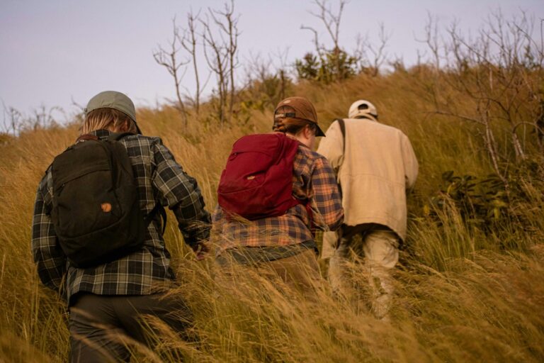
The walk begins at a fenced entrance near Kwa Matu and follows the forest edge past clearings where cattle often graze. The ground is gentle and the pace feels easy, so this is the time to settle your layers. If the morning is cold, start in a fleece, but take it off before the climbing starts or you will soak it with sweat.
Stage 2: Down to the river and back up
The first surprise on the Table Mountain hike is that you go down before you go up. A steep descent drops to a river crossing, then a hard climb of about 350 m takes you out of the valley. Stinging nettles grow along parts of this section, so long trousers are far better than shorts here, even on a warm day.

Stage 3: The forest climb
The forest climb is where the day is won or lost. The path steepens into what feels like a near-vertical stretch of about a kilometre, with roots and mud for footholds and the occasional hands-on-knees step. Short, steady steps and regular sips of water work better than fast bursts and long rests. Trekking poles help on the steepest pitches.
Stage 4: The rocky band and the moorland
Above the trees you cross a rocky section, then the ground opens into moorland. This is where the bogs begin. Tussock grass hides water between the clumps, and on some slopes the soaked ground runs uphill so that hikers joke about a “vertical bog”. Step on the tussocks rather than between them, and test soft patches with a pole before you commit your weight.
Stage 5: The summit plateau
The top is a broad, flat plateau of rock, grass and small ponds rather than a pointed peak. Give yourself time to walk to the edges for the views over the deep valleys and cliffs. The plateau is exposed and often very windy, so put on your warm layer and shell as soon as you stop, not after you start shivering.
The descent
Coming down usually takes 2-3 hours and is slower than people expect, because the bog and forest mud are slippery underfoot. Stay close to your ranger or guide. On the moorland the paths fade and branch, and taking a wrong fork on the way down is one of the most common ways the Table Mountain hike runs late.
Table Mountain hike at a glance
| Detail | Table Mountain hike (Aberdares) |
|---|---|
| Common start points | Kwa Matu (about 2,770 m) or Mikeu, both in the Wanjohi Valley |
| Summit | Roughly 3,800 m, a flat summit plateau |
| Return distance | About 11 km from Kwa Matu; about 16 km from Mikeu |
| Elevation gain | About 1,000 m, plus the extra climb out of the river valley |
| Time up / down | 3-5 hours up, 2-3 hours down for most groups |
| Terrain | Forest edge, river crossing, steep montane forest, rock band, boggy moorland |
| Difficulty | Moderate to hard; good fitness needed |
| Escort | Armed KWS ranger arranged before you start |
How Do You Get to the Table Mountain Hike from Nairobi?
The Table Mountain hike starts about 155 km from Nairobi, a drive of roughly 3.5-4 hours each way. You leave on the Nairobi-Nakuru highway, turn off towards Njabini, pass through Engineer to the KWS office at Ndunyu Njeru, then continue towards Ol Kalou before turning off to the Wanjohi Valley.
Driving from Nairobi, step by step
- Take the Nairobi-Nakuru highway over the upper escarpment for about 60 km to the junction known as the Flyover.
- Cross over and follow the road for about 24 km to Njabini.
- At Njabini, turn onto the Ol Kalou road and drive through Engineer to the KWS office at Ndunyu Njeru, where you pay park entry and meet your ranger.
- Continue for about 30 km towards Ol Kalou, then turn right towards Kwa Matu, roughly 10 km from the turn-off.
- The last 4 km or so is rough murram. Saloon cars usually manage it when dry; after heavy rain a vehicle with more ground clearance is the safer choice.
Can you get there by matatu?
You can, but it takes most of a day each way. Matatus run from Nairobi to Ndunyu Njeru, where you pay at the KWS office, and local matatus or boda bodas go on to Kwa Matu. Confirm the current Nairobi stage before you travel, and plan to camp nearby the night before, because a same-day return by public transport is very hard to fit around a 5-10 hour hike.
Do You Need a KWS Ranger and Park Fees for Table Mountain?
Yes. Table Mountain lies inside Aberdare National Park, which Kenya Wildlife Service manages, so you pay park entry and walk with an armed KWS ranger. Buffalo and elephant are common in the Aberdares, and the forest is thick enough that you can meet them at close range.
Hikers usually pay and arrange the ranger at the KWS office in Ndunyu Njeru on the way in, and recent reports say payment there is by M-Pesa. Fees change, so confirm the current Aberdare entry and ranger charges on the Kenya Wildlife Service website or by calling the park before you go. Call ahead for a weekend hike too, so a ranger is free when you arrive.
The ranger is there first for wildlife safety. Many know the route well, but carry an offline map or a GPS track on your phone as well, because mist can close in on the moorland within minutes and paths there are faint.
When Is the Best Time to Do the Table Mountain Hike?
The best time for the Table Mountain hike is in the drier months, roughly January to February and June to September. Rain can fall in the Aberdares in any month, so pack waterproofs every time, but you will meet far less mud and fog outside the long rains (about March to May) and short rains (about October to December).
| Months | Typical conditions | What it means on the trail |
|---|---|---|
| January-February | Among the driest months | Firmer paths and clearer views; still carry a shell |
| March-May | Long rains | Deep mud, flooded bogs, frequent fog; the hardest season |
| June-September | Drier but cold, especially June-August | Good walking; cold, windy summit and chilly early starts |
| October-December | Short rains | Afternoon showers likely; start early and wear gaiters |
What time should you start?
Start walking by about 8:00 am. Rain and mist in the Aberdares tend to build through the day, and you want to be off the moorland and back near the trailhead by late afternoon. Agree a turn-around time with your group before you set off, for example 1:00 pm, and stick to it even if the summit looks close.
What to Wear and Pack for the Table Mountain Hike
For the Table Mountain hike, dress for a cold, wet mountain rather than a Nairobi weekend walk: waterproof boots, gaiters, long trousers, wool socks, a warm layer, a waterproof shell, gloves, and at least 2-3 litres of water. The bogs and the summit wind are what catch people out.
Footwear and the bogs
Waterproof, ankle-high boots with deep lugs make a big difference on the Table Mountain hike. The Quechua waterproof hiking boot suits hikers who want a lighter pair for day hikes, while the Lowa Renegade GTX Mid gives more support on long, rough descents. Add a pair of waterproof leg gaiters to stop bog water and mud pouring in over the top, and wear merino wool hiking socks, which stay warm even when damp. Pack a spare pair of socks for the drive home.

Layers for a cold, windy summit
Wear a quick-drying base layer, carry a fleece or light insulated jacket, and keep a proper waterproof shell at the top of your pack. Our rain jackets and waterproof rain pants are the two items that keep a wet day safe instead of miserable. On the plateau, Thinsulate waterproof gloves and a warm hat let you enjoy the views rather than rushing down. Our post on what to wear hiking in Kenya explains the layering system in more detail.
Pack, water and light
A 25-30 litre daypack holds everything for the Table Mountain hike, such as our 28-litre daypack. Many hikers prefer a 3L hydration backpack so they can drink on the steep forest climb without stopping. Carry a rechargeable headlamp as well: if the descent runs late, the forest gets dark early.
Table Mountain hike kit list
| Item | Why you need it on the Table Mountain hike |
|---|---|
| Waterproof boots | Bogs, river crossing and slippery forest mud |
| Gaiters | Keep bog water, mud and nettles off your lower legs |
| Long trousers | Stinging nettles on the early climb |
| Fleece or insulated jacket | Cold, windy plateau and long stops |
| Rain jacket and rain pants | Showers and mist can arrive in any month |
| Gloves and warm hat | Summit wind chill |
| 2-3 litres of water | Long, steep climb with few safe refill points |
| Headlamp | A late finish in the forest |
| Snacks and lunch | 5-10 hours of hard walking |
| Phone with offline map, ID, M-Pesa | Route-finding in mist and paying KWS |
You do not need to spend a fortune on any of this. Most of what we sell is quality thrifted gear from well-known outdoor brands, with some new items, which makes waterproof boots and proper shells far more affordable. If you want to try boots on with your hiking socks before the day, drop by our gear shop in Mountain Mall along Thika Road, open Monday to Friday 8:30 am-6:00 pm, Saturday 9:00 am-2:00 pm and Sunday by appointment.
Gear up for your next hike
Shop quality hiking and outdoor gear at great prices — from socks and gloves to hats, balaclavas and camping fuel. Everything you need for Kenya’s trails, delivered fast.
Pro Tips for the Table Mountain Hike
- Leave Nairobi by 5:00 am: the drive takes 3.5-4 hours and you want to be walking by about 8:00 am.
- Call KWS ahead: confirm fees and ranger availability for your date, especially on weekends.
- Step on the tussocks: the water sits between the grass clumps, not on top of them.
- Set a turn-around time: agree it before you start and keep to it, summit or not.
- Keep a dry bag: put your warm layer and spare socks in a waterproof bag inside your pack.
- Download the map: mobile signal is patchy, and mist can hide the path on the moorland.
How Hard Is Table Mountain Compared With Other Hikes Near Nairobi?
The Table Mountain hike is harder than Mt Longonot or the Ngong Hills and a little shorter than Elephant Hill. The altitude, the steep forest wall and the bogs make it a step up from the popular Rift Valley day hikes, so it suits people who already have a few full-day hikes behind them.
The Mt Longonot hike is about 13.5 km with a summit near 2,776 m, so it is a fair test of your legs but gives you no real taste of altitude or cold. The Elephant Hill hike, also in the Aberdares, is longer at around 18-19 km and similar in feel, with bamboo mud instead of a river valley. If you have done Elephant Hill comfortably, the Table Mountain hike will feel familiar. For more ideas at every level, see our round-up of the best day hikes near Nairobi.

How should you train for the Table Mountain hike?
Train with 4-6 weeks of regular walking and at least two long hill days. A good build-up is a Ngong Hills traverse, then Mt Longonot, then a full-day hike of 6 hours or more, ideally with some steep ground. During the week, climbing stairs with a loaded daypack strengthens the same muscles you use on the forest wall. Break in your boots on these training hikes, never on the day itself.
What are the common mistakes on the Table Mountain hike?
The most common mistakes are starting late, wearing trainers into the bogs, carrying too little water and leaving warm layers in the car because Nairobi was sunny. Another is walking ahead of the ranger to set a fast pace. Stay together: the ranger is there for buffalo and elephant, and fog can split a spread-out group within minutes. Read our tips for hiking safely in the rain before a wet-season attempt.
Joining Our Guided Table Mountain Hike
We run a guided Table Mountain hike from Nairobi, with the next date on Saturday 7 November 2026. Going with a group means the transport, KWS arrangements and timing are planned for you, so you can concentrate on the climb itself.
The meeting point, departure time, what is included and how to book are listed on the Table Mountain day hike page. Because 7 November falls in the short rains, plan for mud and at least one shower, and bring the waterproofs and gaiters listed above. If you are unsure whether your fitness or your boots are ready, message us on WhatsApp and we will tell you plainly what to expect. Our rainy season hiking gear post is also worth a read before the date.
Hike Table Mountain with us on Saturday 7 November 2026
Join our guided Table Mountain hike in the Aberdares, leaving from Nairobi. See the meeting point, what is included and how to book your place.
Frequently Asked Questions
How long does the Table Mountain hike take?
The Table Mountain hike takes most groups 5-10 hours on the trail: about 3-5 hours up and 2-3 hours down. The time depends on the start point, your fitness and how wet the bogs are. Add roughly 3.5-4 hours of driving each way from Nairobi, so treat it as a full day that starts before 5:00 am and ends after dark.
Is Table Mountain in the Aberdares OK for beginners?
The Table Mountain hike is not a good first outing. The steep forest climb, the altitude of roughly 3,800 m and the boggy moorland make it demanding even for fit people. Beginners should first complete easier day hikes such as Ngong Hills and Mt Longonot. Once you can walk 6 hours on hilly ground without struggling, Table Mountain becomes a realistic and rewarding next step.
Can I hike Table Mountain without a guide?
Table Mountain lies inside Aberdare National Park, so you hike with an armed KWS ranger rather than alone, mainly because of buffalo and elephant. A ranger is not the same as a dedicated hiking guide, though. Carry an offline map or GPS track, stay together as a group, and turn back if thick fog hides the path on the moorland.
Is Table Mountain the same as Ol Donyo Lesatima or Kinangop?
Table Mountain is a separate summit. Ol Donyo Lesatima, at about 4,000 m, is the highest point of the Aberdares and lies roughly 8 km to the north across the moorland. Kinangop is the range’s second major peak, further south. Some multi-day treks link Table Mountain with Lesatima, but the usual Table Mountain hike starts from the Wanjohi Valley side.
How cold does it get on top of Table Mountain?
The summit of Table Mountain is far colder than Nairobi because it sits roughly 2,000 m higher and is exposed to strong wind. Even on a sunny day you will want a fleece, a windproof shell, gloves and a hat when you stop. In mist or rain the damp makes it feel colder still, so keep a dry warm layer in your pack.
Final Thoughts
Treat Table Mountain as a real mountain day, not a park stroll. The Table Mountain hike asks for an early start, a KWS ranger, waterproof boots with gaiters and warm layers for the plateau, and in return gives you one of the most varied climbs within a day’s reach of Nairobi.
Pick a dry-season date or join our guided hike on 7 November, sort your boots and shell a couple of weeks before, and break them in on a shorter hill first. Then all that is left is the 5:00 am alarm.
Not sure your boots will survive the Aberdares bogs?
Our team can help you choose the right gear, answer your hiking questions and get your order dispatched quickly. Message us for a quick, straight answer.