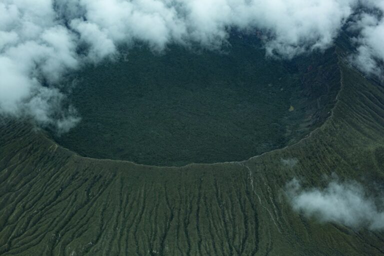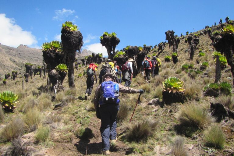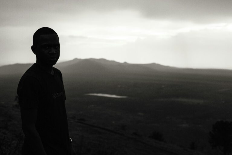

From shaded forest paths a short drive from Nairobi’s city centre to 4,985 m on Point Lenana, the best hikes in Kenya cover every level of fitness. For most people that means Ngong Hills or Mt Longonot for a first summit, the Aberdares for long moorland days, and Mt Kenya or Mt Elgon for multi-day treks.
Choosing between them is the hard part. Drive times, altitude, ranger rules and the two rainy seasons all change what a given Saturday can hold. Below we rank fourteen hikes in Kenya by effort, give the real numbers for each one (height, hours, distance from Nairobi), and cover when to go, how to get there and what to carry.

Kenya Hiking: Quick Facts
- Highest walkable point: Point Lenana on Mt Kenya, 4,985 m; Batian (5,199 m) and Nelion (5,188 m) need technical climbing.
- Closest trail to Nairobi: Karura Forest, about 5 km from the CBD, with more than 50 km of paths.
- Classic day volcano: Mt Longonot, 2,776 m, a 13.5 km gate-to-rim-to-gate circuit of 4-5 hours, about 60 km from Nairobi.
- Highest point in the Aberdares: Oldoinyo Lesatima, about 4,000 m.
- Driest hiking months: roughly January-February and June-September; long rains fall around March-May and short rains around October-December.
- Fees and escorts: national parks are run by Kenya Wildlife Service (KWS) and forest reserves by the Kenya Forest Service (KFS); confirm current fees with them before you travel.
How Do the Best Hikes in Kenya Compare?
The best hikes in Kenya fall into three bands: easy and moderate day hikes within two hours of Nairobi, hard day hikes in the Aberdares, and multi-day mountains. The table sets out all fourteen side by side so you can match a trail to your fitness and your free days.
| Hike | Area | High point | Typical time | Effort |
|---|---|---|---|---|
| Karura Forest | Nairobi | City forest | 1-4 hours | Easy |
| Ngong Hills | Kajiado | About 2,460 m | 4-6 hours | Moderate |
| Hell’s Gate | Naivasha | Gorge and cliffs | 3-6 hours | Easy-moderate |
| Ol Donyo Sabuk | Machakos | 2,145 m | 4-6 hours | Moderate |
| Mt Longonot | Nakuru (Naivasha) | 2,776 m | 4-5 hours | Moderate-hard |
| Mt Suswa | Narok/Kajiado | 2,356 m | Full day or overnight | Moderate |
| Menengai Crater | Nakuru | 2,278 m | 4-6 hours | Moderate |
| Elephant Hill | Aberdares | About 3,630-3,658 m | 7-10 hours | Hard |
| Table Mountain | Aberdares | About 3,800 m | 5-10 hours | Moderate-hard |
| Oldoinyo Lesatima | Aberdares | About 4,000 m | 4-7 hours | Moderate-hard |
| Mt Ololokwe | Samburu | About 2,000 m | 3-5 hours up | Hard |
| Kakamega Forest | Western Kenya | Rainforest trails | 2-6 hours | Easy-moderate |
| Mt Elgon | Trans Nzoia/Bungoma | Koitobos, about 4,155 m | 2-4 days | Hard |
| Mt Kenya | Central Kenya | Point Lenana, 4,985 m | 4-7 days | Very hard |
Heights for a few hikes in Kenya’s Aberdares vary between sources by 20-30 m, so we give the commonly quoted range. Times are walking times for a reasonably fit group and do not include the drive from Nairobi.
Which Day Hikes Near Nairobi Are Worth Doing First?
Start with Karura Forest to test your shoes, then Ngong Hills or Ol Donyo Sabuk for a first summit, and Mt Longonot once a five-hour day feels comfortable. All five hikes in Kenya listed here fit into a single day from Nairobi.
For a deeper look at each one, our ranking of day hikes near Nairobi goes trail by trail, with transport tips for each.
Karura Forest
Karura Forest is the easiest of all the hikes in Kenya to reach: it sits inside Nairobi, north of the city centre, bordered by Muthaiga, Gigiri and Runda. The forest covers roughly 1,040 hectares, managed by the Kenya Forest Service with the Friends of Karura Forest community association, and has over 50 km of marked trails.
Use it for a two-hour walk to the waterfall and the caves once used by Mau Mau fighters in the 1950s, or for training laps before harder hikes in Kenya. Flat paths and shade mean trainers are fine here.
Ngong Hills
Ngong Hills is a ridge of knuckle-shaped peaks about 25 km south-west of Nairobi, with a highest point usually given as about 2,460 m. The full ridge walk takes most groups 4-6 hours, with the Rift Valley floor dropping away on one side and the city skyline on the other.
Ngong is one of the most exposed hikes in Kenya. Wind is constant, shade is rare and the red soil turns greasy after rain, so a sun hat, two litres of water and shoes with real lugs matter more than distance suggests.
Hell’s Gate National Park
Hell’s Gate is a small KWS park of about 68 km² near Lake Naivasha, roughly 90 km from Nairobi, and one of the few hikes in Kenya where you can walk or cycle among zebra and giraffe. Fischer’s Tower, a volcanic plug of about 23 m, stands near Elsa Gate.
The main walking draw is the gorge, a narrow channel of carved rock with hot springs near its lower end, plus views of the Olkaria geothermal plant. Keep out of the gorge when storms are building: it drains a large area and floods fast.
Ol Donyo Sabuk (Kilimambogo)
Ol Donyo Sabuk is a lone forested mountain of 2,145 m in Machakos County, about 18 km east of Thika town. The climb is roughly 9-10 km from the gate to the summit, 4-6 hours return, and you walk with a KWS ranger because buffalo live in the forest. Our Ol Donyo Sabuk hike guide has the full route.
Mt Longonot
Mt Longonot is the most popular volcano among day hikes in Kenya. From the gate at about 2,150 m, a 3.1 km path climbs to the crater rim, then a 7.2 km loop circles the rim to the 2,776 m summit, making 13.5 km in total and roughly 4-5 hours with breaks.
The upper sections are eroded, steep and covered in loose ash, which is why so many first-timers come down slower than they went up. Our Mt Longonot hike guide breaks down the rim loop section by section.
Where Are the Best Crater Hikes Beyond the Usual Weekend Trails?
Mt Suswa and Menengai Crater are the best crater hikes in Kenya once Longonot is done. Both are quieter, both show the Rift Valley’s volcanic past up close, and both make a sensible next step before the much higher Aberdares.
Mt Suswa
Mt Suswa rises to 2,356 m between Nairobi and Narok, and its double crater, with a moat-like inner ring around a tilted block of rock, is unlike anything else in East Africa. Lava tubes on the eastern side include a chamber nicknamed the baboon parliament, where baboons roost.
Like several remote hikes in Kenya, Suswa is reached over rough tracks, so a high-clearance vehicle is wise, and most groups hire local Maasai guides at the mountain. Many hikers camp on the outer rim to catch sunrise over the inner crater.
Menengai Crater
Menengai is a caldera of about 12 by 8 km, one of the largest in Africa, sitting just 10 km north of Nakuru town. Its highest point is 2,278 m. Walks along the rim and down into the forested crater floor take most of a day, making it one of the more relaxed crater hikes in Kenya, and Nakuru is an easy base, about a three-hour drive from Nairobi.
Why Do Serious Hikers Head to the Aberdares?
The Aberdares hold the hardest day hikes in Kenya: 3,600-4,000 m peaks reached through bamboo, then open moorland where cold mist can roll in at midday. Expect deep mud, an armed KWS ranger escort and a very early start from Nairobi.
Elephant Hill
Elephant Hill tops out at about 3,630-3,658 m at the southern end of the range, starting from Njabini Forest Station at roughly 2,500 m. The round trip is about 18 km and 7-10 hours, with a climb of more than 1,100 m. Read our Elephant Hill route planner before you go.
Table Mountain
Table Mountain rises to roughly 3,800 m above the Wanjohi Valley in the northern Aberdares, about 155 km from Nairobi. A steep forest climb leads to a flat-topped summit of tussock grass and bog. Our Table Mountain hike guide covers trailheads and timings.
Oldoinyo Lesatima
Oldoinyo Lesatima is the highest point of the Aberdares at about 4,000 m. Trailheads sit high on the moorland, so the climb is modest, but altitude and bogs make 14-17 km feel long. The jagged Dragon’s Teeth rocks line the approach; see our Oldoinyo Lesatima guide.

Which Hikes in Kenya Need More Than a Weekend?
Mt Kenya, Mt Elgon, Mt Ololokwe and Kakamega Forest are the hikes in Kenya that reward a long weekend or more. Distance from Nairobi, altitude or both mean you need at least one night away, and Mt Kenya needs four or more.
Mt Ololokwe
Mt Ololokwe, also called Ol Donyo Sabache, is a flat-topped mountain of about 2,000 m in Samburu County, visible from the Isiolo-Moyale highway. Sheer cliffs ring the summit, and the narrow paths up were first worn by elephants.
Ololokwe starts as one of the hottest hikes in Kenya: the climb takes 3-5 hours, moving from hot thorn bush into cool summit forest with cedars and orchids. The mountain is sacred to the Samburu, and local Samburu guides lead the treks. January-March and July-October are the safest months to walk.
Kakamega Forest
Kakamega Forest in western Kenya is a remnant of the Guineo-Congolian rainforest that once stretched across central Africa. Trails here are gentler than most hikes in Kenya’s highlands, but the forest is wet for much of the year, so the challenge is mud and humidity rather than height. Walk with a local guide to find the birds and primates.
Mt Elgon
Mt Elgon is an extinct volcano on the Kenya-Uganda border. The Kenyan side of the national park covers about 169 km², and its highest point, Koitobos, is about 4,155 m (some sources say 4,187 m). Kitum Cave cuts some 200 m into the mountainside.
Most groups spend 2-4 days here, starting from the Kitale side. Weather is often misty and damp, and a ranger escort is required. It is one of the quietest multi-day hikes in Kenya, which is a big part of its appeal.
Mt Kenya
Mt Kenya is the summit hike every Kenyan hiker eventually plans. Batian (5,199 m) and Nelion (5,188 m) are technical rock climbs, so trekkers aim for Point Lenana at 4,985 m over 4-7 days on the Sirimon, Naro Moru or Chogoria routes. Our Mt Kenya hiking guide compares the routes.
Not ready for the summit? A day walk from Naro Moru gate through forest and bamboo to the Met Station, at about 3,050 m, is roughly 20 km and seven hours return and ranks among the most underrated day hikes in Kenya.

When Is the Best Time for Hikes in Kenya?
The best time for hikes in Kenya is the drier spells of January-February and June-September. The long rains fall roughly March-May and the short rains roughly October-December, turning forest trails to mud and bringing afternoon storms to the ridges.
| Months | Typical conditions | Good choices |
|---|---|---|
| January-February | Dry, hot on the Rift Valley floor, clear mornings | Mt Kenya, Aberdares, Longonot, Ololokwe |
| March-May (long rains) | Heavy rain, deep mud, some park roads hard going | Karura, Ngong Hills on dry mornings |
| June-September | Mostly dry, cold nights at altitude, cloudy Nairobi mornings | Almost every trail; peak season for Mt Kenya |
| October-December (short rains) | Showers, often in the afternoon; green hills | Early-start day hikes, Hell’s Gate, Ol Donyo Sabuk |
Right now the short rains are settling over Nairobi, so for hikes in Kenya this month, start early and plan to be off ridges by early afternoon. Our notes on hiking safely in the rain explain how to read the sky and when to turn back.
What Should You Wear and Pack for Hikes in Kenya?
For day hikes in Kenya, carry two to three litres of water, a waterproof layer, sun protection and footwear with deep lugs. For the Aberdares, Mt Elgon and Mt Kenya, add warm layers, gloves, a headlamp and gear for sub-zero nights.
Kit for a day hike
A 20-30 litre daypack such as our 28L day hiking backpack holds water, lunch, a rain shell and a warm layer without dragging on your shoulders. On wet trails, a waterproof boot with a high collar, like the Quechua Forclaz 500 High waterproof boot, keeps mud out on Elephant Hill and grips Longonot’s ash on the way down.
Socks matter as much as boots. A pair of merino wool hiking socks stays warm when damp and cuts blisters on long descents. For a full list by trail type, use our hiking gear checklist for Kenya, and see what to wear hiking in Kenya for clothing.
Extra kit for altitude and nights out
On the high hikes in Kenya, above 3,500 m, the temperature can fall below freezing overnight, even on the equator. Add a fleece, an insulated jacket, a beanie, gloves and a headlamp such as our waterproof rechargeable headlamp for summit nights. Waterproof rain pants earn their weight in Aberdares bogs. The full Mt Kenya list is in what to pack for hiking Mt Kenya.
Most of our stock is quality thrifted gear from well-known outdoor brands, with some new items, which keeps a solid kit affordable. You can order online and pay with M-Pesa, or drop by Shop D39 on Thika Road at Mountain Mall, 3rd Floor, Nairobi, open Monday-Friday 8:30am-6:00pm and Saturday 9:00am-2:00pm.
Gear up for your next hike
Shop quality hiking and outdoor gear at great prices — from socks and gloves to hats, balaclavas and camping fuel. Everything you need for Kenya’s trails, delivered fast.
Pro Tips: Planning Your First Big Kenyan Hike
- Step up gradually: Karura, then Ngong Hills, then Longonot, then an Aberdares peak, then Mt Kenya.
- Leave Nairobi early: a 5:00am start beats Thika Road and Waiyaki Way traffic and gets you off ridges before afternoon storms.
- Check the escort rules: Ol Donyo Sabuk, the Aberdares and Mt Elgon normally need a ranger; ask KWS when you book.
- Carry cash and M-Pesa: some gates, guides and village shops near trailheads prefer one or the other.
- Tell someone your plan: share the trail name, start time and expected return with a friend in Nairobi.
- Break in boots first: wear new or new-to-you boots on two short walks before a long mountain day.
How Do You Get to Kenya’s Trailheads From Nairobi?
Most hikes in Kenya are easiest by private car, but several near Nairobi work by matatu. Ngong town, Naivasha-bound routes for Longonot, and Thika-bound routes for Ol Donyo Sabuk all leave from the city; confirm the stage and the drop-off with the conductor.
Two of the closest hikes in Kenya, Hell’s Gate and Longonot, share the Nairobi-Naivasha road, so you can combine them on a long weekend. The Aberdares, Mt Suswa and Mt Elgon need a high-clearance vehicle for the final tracks, especially in the rains. For Mt Kenya, the Sirimon and Naro Moru gates lie off the Nanyuki side of the mountain, while Chogoria is reached from the east.
Park entry fees change, and citizen, resident and non-resident rates differ, so check current charges directly with Kenya Wildlife Service for national parks and the Kenya Forest Service for forest reserves before you travel.
Common mistakes on Kenyan trails
The same few errors spoil most hikes in Kenya. People underestimate sun on the Ngong ridge and run out of water. They wear cotton on the Aberdares and get chilled when mist rolls in. They start Longonot at 11am and descend the loose ash in the heat. And they pick Mt Kenya as a first hike, when two or three high day hikes would teach them how their body copes above 3,500 m.
Can You Join a Guided Hike With Us?
Yes. We run guided hikes from Nairobi to several of the best hikes in Kenya, including Mt Longonot, Ol Donyo Sabuk, Table Mountain and Oldoinyo Lesatima and the Dragon’s Teeth.
Dates change through the year, so check our hike calendar for the next departures or ask us on WhatsApp. New to hiking? Read hiking for beginners in Kenya first, then pick a group day hike as your starting point.
Ready to hit the trail?
Join one of our upcoming guided hikes — from beginner-friendly day hikes to longer treks across Kenya’s best routes.

Frequently Asked Questions
What is the easiest hike near Nairobi?
Karura Forest is the easiest hike near Nairobi. It lies inside the city, about 5 km from the CBD, with more than 50 km of mostly flat, shaded trails, a waterfall and historic caves. You can walk for one hour or four, trainers are fine, and there is no climb to speak of. For a first real summit, try Ngong Hills next.
Which is the hardest hike in Kenya?
Mt Kenya is the hardest hike in Kenya for non-climbers, reaching 4,985 m at Point Lenana over 4-7 days, with freezing nights and real altitude-sickness risk. Among day hikes, Elephant Hill in the Aberdares is usually rated toughest: about 18 km return, more than 1,100 m of climbing and deep bamboo mud, often in 7-10 hours.
Can you hike in Kenya during the rainy season?
You can hike in Kenya during the rainy seasons, but plan around the weather. Rain usually falls in the afternoon, so start early and be off exposed ridges by about 1pm. Avoid gorges such as Hell’s Gate during storms, expect mud in the Aberdares, and pack a waterproof jacket and rain pants. Lower trails like Karura are the safest bet.
Do I need a guide for hiking in Kenya?
A guide is not needed for Karura Forest or Mt Longonot, but many hikes in Kenya require one. The Aberdares, Ol Donyo Sabuk and Mt Elgon normally need a KWS ranger escort because of buffalo and elephants, Mt Ololokwe is walked with Samburu guides, and Mt Kenya climbs are far safer with a licensed guide. Confirm the rules with KWS before you go.
Is it safe to hike alone in Kenya?
Hiking alone in Kenya is possible on busy trails such as Karura Forest and Mt Longonot, but a group is safer on remote hikes in Kenya. Tell someone your route and return time, carry a charged phone, avoid walking after dark and follow ranger rules where wildlife roams. Joining a guided group hike from Nairobi is the easiest way to start.
Final Thoughts
Kenya gives you a ladder of mountains to climb, from a forest walk in Nairobi to a freezing dawn on Point Lenana. Climb it a rung at a time: Karura and Ngong Hills first, Longonot or Ol Donyo Sabuk next, the Aberdares when you can handle ten hours and cold mist, and Mt Kenya once all that feels easy.
Pick one of these hikes in Kenya for your next free weekend, check the season and the escort rules, then get your daypack, boots and rain layer sorted before the date.
Not sure which Kenyan trail should be your next one?
Our team can help you choose the right gear, answer your hiking questions and get your order dispatched quickly. Message us for a quick, straight answer.