The Swahili name Kilimambogo means “buffalo hill”, and the Ol Donyo Sabuk hike lives up to it. The walk climbs about 9-10 km from the Kenya Wildlife Service gate to the 2,145 m summit, mostly on a rough, rocky park road through montane forest. Allow 4-6 hours return, with a KWS ranger beside you.
For Nairobi hikers the appeal is obvious: the park sits off the Thika-Garissa road, roughly two hours’ drive from the city, and the climb is long enough to feel like a real mountain day without needing a 4 am start. Below you will find the route stage by stage, directions by car and matatu, ranger and safety notes, the best months, a kit list for the stony track, and how to join our guided Ol Donyo Sabuk hike on Saturday 21 November 2026.

Ol Donyo Sabuk Hike: Quick Facts
- Summit: 2,145 m, a lone forested mountain also called Kilimambogo or Kyanzavi.
- Location: Ol Donyo Sabuk National Park, Machakos County, about 18 km east of Thika town.
- Distance and time: About 9-10 km gate to summit, 18-20 km return, usually 4-6 hours.
- Climb: Roughly 700-750 m of ascent, steepest and rockiest in the final kilometres.
- Wildlife: Buffalo are the main residents, along with colobus and Sykes’ monkeys, baboons, bushbuck and rock hyraxes.
- Access: KWS park entry, and hikers walk with a KWS ranger because of the buffalo.
- Our next guided date: Saturday 21 November 2026, from Nairobi.
What Is the Ol Donyo Sabuk Hike Like?
The Ol Donyo Sabuk hike is a steady uphill walk on a gravel and boulder road that winds through thick forest to a summit with telecom masts and the MacMillan graves nearby. It is long rather than technical, and the descent is harder on the knees than the climb.
Most of the Ol Donyo Sabuk hike follows the park road that vehicles also use, so you will not be scrambling or route-finding. What you will be doing is climbing almost without a break. The gradient eases in a few places, but for two to three hours it mostly goes one way: up. Loose stones and exposed rock make the surface uneven, which is why the walk down tends to take nearly as long as the walk up.
The forest is the highlight of the Ol Donyo Sabuk hike for many people. Low on the mountain it is warm and open, with farmland and the Athi plains spread out below. Higher up, the trees close in, the air cools, and black-and-white colobus monkeys often crash about in the canopy. Buffalo tracks and dung on the road are a reminder of who owns the place.
Why is Ol Donyo Sabuk called Kilimambogo?
Kilimambogo joins the Swahili word kilima (hill) with mbogo (buffalo), so the name means buffalo hill. Ol Donyo Sabuk is Maasai for “big mountain”, which fits a peak that rises alone from flat ground, and the Kamba name, Kyanzavi, is linked to nzavi, the lablab bean.
All three names point to the same mountain, and you will see all three on signboards, matatus and maps. Locals around Donyo town mostly say Kilimambogo, which is worth knowing when you ask for directions to the Ol Donyo Sabuk hike or flag down a matatu in Thika.
Where is Ol Donyo Sabuk in Kenya?
Ol Donyo Sabuk lies in Machakos County, close to the Kiambu border, about 18 km east-southeast of Thika along the A3 Thika-Garissa road. The national park covers about 20.7 km² around the mountain and has been managed by the Kenya Wildlife Service since it was gazetted in 1967.
From the summit area you look out over the Thika and Athi river country, pineapple and coffee farms, and on a clear morning north to Mt Kenya. Some hikers also report seeing Kilimanjaro far to the south and the Masinga Dam to the east, though haze often hides both. Do not expect a sweeping 360-degree panorama from the very top: trees and masts crowd the summit, and the best views come from the lookout points lower down.
Ol Donyo Sabuk Hike Route, From Gate to Summit
The Ol Donyo Sabuk hike starts at the KWS main gate near Donyo town and follows the park road to the summit and back the same way. Expect three stages: open lower slopes, a long forested middle section, and a steeper, rockier final push past the MacMillan graves.
| Detail | Ol Donyo Sabuk hike (Kilimambogo) |
|---|---|
| Start and finish | KWS main gate, about 2 km from Donyo town |
| Summit height | 2,145 m |
| Distance | About 9-10 km each way, 18-20 km return |
| Ascent | Roughly 700-750 m |
| Time | 2-3 hours up, 4-6 hours return |
| Surface | Gravel and boulder-strewn park road, short rocky footpaths |
| Difficulty | Moderate: steady climbing, steep rocky descent |
| Escort | KWS ranger, because of buffalo |
Stage 1: The gate and the lower slopes
The first hour of the Ol Donyo Sabuk hike climbs out of the gate area through bush and open woodland. The road is wide, the sun is strong, and you can see Donyo town and the farms behind you shrinking quickly. This is the warmest part of the day’s walking, so drink early and keep your hat on, even if the morning feels cool when you set off.
Stage 2: Into the forest
Somewhere around the halfway mark, the Ol Donyo Sabuk hike enters denser montane forest. The temperature drops a few degrees, the road becomes more rutted, and the light turns green. This is the best section for colobus monkeys and birds; the park has more than 45 recorded bird species, including augur buzzards and African hawk eagles. A few bends open onto lookout points over the plains, and they make natural places to regroup.
Stage 3: The MacMillan graves and the summit
About 2 km below the top, a short detour leads to the graves of Sir William Northrup McMillan, the American settler who once owned much of this land as Juja Farm, his wife Lady Lucie, and Louise, who worked for the family for most of her life. Beyond the graves, the Ol Donyo Sabuk hike steepens and gets rockier. The summit itself is a cluster of masts among trees at 2,145 m, so most groups take their summit photos and then drop back to the nearest lookout for a proper view and a snack.
Is there a footpath instead of the road?
Yes. Some groups use a steeper and rougher line known as the Rock Hyrax route for part of the climb, which trades road kilometres for rock and gradient. Whether you can use it on your Ol Donyo Sabuk hike depends on conditions and your ranger, so ask at the gate. If it has rained, the road is the safer choice.

How Do You Get to Ol Donyo Sabuk From Nairobi?
To reach the Ol Donyo Sabuk hike from Nairobi, take Thika Road (the A2) to Thika, then the Garissa road east to Makutano junction, where KWS signs point you to Donyo town and the park gate. The drive is about 70-85 km and usually takes 1.5-2 hours, depending on traffic.
Driving directions
- Leave Nairobi on Thika Road past Roysambu, Kasarani, Ruiru and Juja to Thika town.
- At Thika, join the Thika-Garissa road (A3) and drive about 22 km east to Makutano junction.
- Follow the KWS signs and turn right onto the all-weather murram road for about 4 km to Donyo town.
- In Donyo town, turn right and drive about 2 km to the main gate.
These are the directions Kenya Wildlife Service gives, and any saloon car manages the murram in dry weather. If you plan to drive up the mountain rather than walk, a high-clearance vehicle is wiser, because the upper road is rough and rocky. Leaving Nairobi by 6:00 am for the Ol Donyo Sabuk hike gets you ahead of the Thika Road traffic and onto the trail while the forest is still cool.
Can you get to Ol Donyo Sabuk by matatu?
You can. Take a Thika matatu from Nairobi CBD, then a matatu signed Kilimambogo or Donyo Sabuk from Thika to Donyo town. From the town, the gate is about 2 km away, which you can walk in 20-30 minutes or cover on a boda boda. Give yourself an extra hour each way compared with driving, and agree your return plan before you start, because the last matatus back to Thika thin out in the evening.
How far is Ol Donyo Sabuk from Thika?
Ol Donyo Sabuk is about 25 km from Thika town by road: roughly 22 km on the Garissa road plus a few kilometres of murram through Donyo town. That puts the Ol Donyo Sabuk hike within easy reach of anyone living along the Thika Road corridor, from Kasarani and Githurai to Ruiru and Juja.
Do You Need a Ranger for the Ol Donyo Sabuk Hike?
Yes. The Ol Donyo Sabuk hike is inside a national park with a large buffalo population, so hikers walk with a KWS ranger. You book the ranger and pay park entry at the gate or through KWS before your visit, and you start walking only once your ranger is with you.
Fees for citizens, residents and non-residents change from time to time, and ranger and vehicle charges are separate from entry. Check current rates with Kenya Wildlife Service’s Ol Donyo Sabuk page before you go rather than trusting figures in older trip reports. KWS lists the gates as open from 6:00 am to 6:00 pm, and it runs a public campsite (Turacco) and a special campsite near the summit if you want to stay the night.
What should you do if you meet a buffalo?
Stop, stay quiet and let the ranger decide what happens next. Buffalo met on the Ol Donyo Sabuk hike are used to vehicles but can charge if surprised or cornered, especially lone bulls. Never walk ahead of the ranger, never approach for a photo, and give any animal on the road a wide berth, waiting for it to move off rather than pushing past. Early mornings bring the best chance of a sighting, so stay alert on the first hour of the climb.
When Is the Best Time for the Ol Donyo Sabuk Hike?
The best months for the Ol Donyo Sabuk hike are the drier spells, roughly January to February and June to September. During the long rains (about March to May) and short rains (about October to December) the red soil turns slippery and loose rock makes the descent harder.
| Months | Typical conditions | What it means on the mountain |
|---|---|---|
| January-February | Hot and mostly dry | Firm road, dusty lower slopes, strong midday sun |
| March-May | Long rains | Slippery red soil, muddy murram, slower and harder descent |
| June-September | Cool, often overcast, mostly dry | Comfortable climbing temperatures; mist may hide the views |
| October-December | Short rains | Green forest, afternoon showers likely; start early and pack a shell |
Our 21 November date falls in the short rains. That usually means a bright, warm morning, a chance of a shower after lunch, and a greener mountain than in the dry season. Start early, pack a light rain jacket, and take the descent slowly if the road is wet.
What time should you start the climb?
Aim to start the Ol Donyo Sabuk hike by 7:00-7:30 am. A morning start keeps the steep lower slopes in shade for longer, gives you the best chance of clear views to Mt Kenya, and leaves plenty of time to be down before the afternoon cloud and the 6:00 pm gate closing. If you are adding Fourteen Falls, an early start is the only way to fit both in comfortably.
What to Wear and Pack for the Ol Donyo Sabuk Hike
For the Ol Donyo Sabuk hike, wear supportive boots with a grippy sole, light breathable clothing, a sun hat and sunglasses, and carry 2-3 litres of water, a rain jacket, snacks and a small first-aid kit. A trekking pole makes the rocky descent much kinder to your knees.
Boots and poles for a stony road
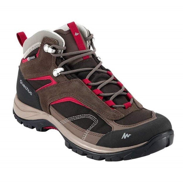
The surface is the thing to plan for on the Ol Donyo Sabuk hike. Loose gravel and rounded boulders roll underfoot, and on the way down every step puts weight on your toes and knees. A light, waterproof boot with a lugged sole, such as the Quechua MH100 hiking boots, gives far more grip and ankle support than gym trainers. Pair them with an ultralight foldable trekking pole for the descent; it folds into a daypack for the climb and comes out when the stones start to slide.
Water, sun and the afternoon shower
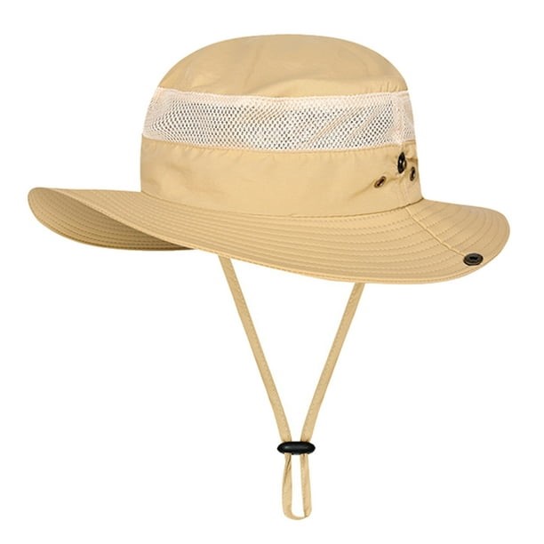
There is no reliable drinking water on the mountain, and the lower slopes can be hot by 10:00 am, so carry at least 2-3 litres per person. A 3L hydration backpack lets you sip as you climb instead of stopping to dig out bottles. Cover your head with a wide-brim safari hiking sun hat, because the equatorial sun at 2,000 m burns faster than it does in Nairobi. In the rainy months, add a light waterproof shell; our post on what to wear hiking in Kenya explains how to layer for warm mornings and wet afternoons.
Ol Donyo Sabuk hike kit list
| Item | Why it matters on Kilimambogo |
|---|---|
| Hiking boots with deep lugs | Grip on loose gravel and boulders, ankle support on the descent |
| Trekking pole | Takes strain off knees on the steep way down |
| 2-3 litres of water | Hot lower slopes and no reliable water source |
| Sun hat, sunglasses, sunscreen | Little shade for the first hour; strong UV at altitude |
| Quick-dry T-shirt | You will sweat on the climb and cool down fast at the top |
| Light rain jacket | Short-rains and long-rains showers, wind at the summit |
| Snacks or packed lunch | 4-6 hours on the move; no food sold on the mountain |
| ID, cash and M-Pesa | Park entry, ranger and the Fourteen Falls fee |
None of the kit for an Ol Donyo Sabuk hike needs to be bought new. Most of what we sell is quality thrifted gear from well-known outdoor brands, along with some new items, which keeps decent boots, packs and shells affordable for a first mountain. You can order online and pay by M-Pesa, or try boots on with your hiking socks at our Mountain Mall gear shop, 3rd Floor, Shop D39, on Thika Road in Nairobi, which sits right on your route out to Kilimambogo. We are open Monday to Friday 8:30 am-6:00 pm, Saturday 9:00 am-2:00 pm, and Sunday by appointment.
Gear up for your next hike
Shop quality hiking and outdoor gear at great prices — from socks and gloves to hats, balaclavas and camping fuel. Everything you need for Kenya’s trails, delivered fast.
Pro Tips for Kilimambogo
- Beat the traffic: leave Nairobi by 6:00 am so you are past Juja before Thika Road fills up.
- Drink before you are thirsty: the open lower slopes are the hottest part of the walk.
- Shorten your steps downhill: small, flat-footed steps keep the loose stones from rolling.
- Stay behind the ranger: buffalo can be standing just round the next bend.
- Use the lookouts: the views are better from the lookout points than from the masts on top.
- Keep a dry layer: a T-shirt soaked from the climb gets cold fast in summit wind.
Is the Ol Donyo Sabuk Hike Good for Beginners?
Yes, for beginners with reasonable fitness. The Ol Donyo Sabuk hike has no scrambling, exposure or route-finding, but it is a long, steady climb with a steep, rocky descent, so it suits people who already manage a 2-3 hour walk comfortably. Anyone with knee problems should think twice.
Compared with other day hikes near Nairobi, Kilimambogo sits in the middle. The Ngong Hills are gentler and more open, with less sustained climbing. Mt Longonot is shorter in distance but steeper and dustier, with a crater rim that leaves you exposed to sun and wind. Ol Donyo Sabuk is longer than both on foot, shadier higher up, and easier to reach for anyone on the Thika Road side of town. Our round-up of the best day hikes near Nairobi lists more trails at each level, and our post on hiking for beginners in Kenya covers the basics of pacing and preparation.
How should you train for it?
Two or three weeks of regular walking is enough preparation for the Ol Donyo Sabuk hike for most people. Build up to one 2-3 hour walk with hills each weekend, such as Karura Forest or the Ngong Hills, and add stair climbing during the week. Practise walking downhill too, because the descent is where tired legs struggle. Wear the boots you plan to use on these training walks, so any hot spots show up before the day.
What mistakes do people make on Kilimambogo?
On the Ol Donyo Sabuk hike, the most common mistakes are wearing smooth-soled trainers, carrying only one bottle of water, and starting at 10:00 am in full sun. Another is rushing the descent. People feel fine at the top, then speed down the loose road and end up with sore knees or a twisted ankle. Slow down, use a pole, and if the road is wet after rain, read our tips on hiking safely in the rain before you go.
Can You Combine Ol Donyo Sabuk With Fourteen Falls?
Yes. Fourteen Falls, a wide series of waterfalls on the Athi River at about 1,400 m, lies a few kilometres from the park, near the junction off the Garissa road. Many groups visit after the Ol Donyo Sabuk hike, when tired legs appreciate a short, flat walk and a picnic by the water.
The falls are run separately from the national park, so expect a separate entry charge there and confirm it on the day. The flow is strongest during and just after the rains, which makes November a good month to see them. Keep well back from the edge and away from the water on the rocks, which are slippery and drop into fast currents, and keep a close eye on children.
Joining Our Guided Ol Donyo Sabuk Hike
We run a guided Ol Donyo Sabuk hike from Nairobi, and the next date is Saturday 21 November 2026. Going as a group means a KWS ranger escort and a guided walk to the summit and back are arranged for you, so all you need to bring is your gear, water and food.
The Mt Kilimambogo day hike page lists what is included, what is not, and how to book, along with the optional stop at Fourteen Falls on the way back. Because late November falls in the short rains, pack a light rain jacket alongside your sun hat. If you are not sure whether your fitness or footwear is ready for 18-20 km of road and rock, message us on WhatsApp and we will tell you plainly what the day involves.
Climb Kilimambogo with us on Saturday 21 November 2026
Join our guided Ol Donyo Sabuk day hike from Nairobi: a ranger-escorted climb through buffalo country to the 2,145 m summit, with an optional stop at Fourteen Falls on the way home.
Frequently Asked Questions
How long does it take to climb Ol Donyo Sabuk?
The Ol Donyo Sabuk hike usually takes 2-3 hours to reach the 2,145 m summit and 4-6 hours for the full return trip from the KWS gate. Fit hikers moving steadily finish at the faster end. Groups that stop at the lookouts and the MacMillan graves, or walk down carefully on a wet road, should plan for closer to 6 hours, plus extra time if they add Fourteen Falls.
Is Kilimambogo hard for a first hike?
The Ol Donyo Sabuk hike is a moderate first hike: there is no scrambling, but you climb steadily for 9-10 km and come down a steep, stony road. People who can already walk for 2-3 hours, or who have done Karura or the Ngong Hills, generally manage it well. If you have knee trouble, bring a trekking pole and allow extra time for the descent.
Can I hike Ol Donyo Sabuk without a ranger?
No, plan on walking with a KWS ranger. Ol Donyo Sabuk National Park is home to a large herd of buffalo, which can be dangerous at close range, so rangers accompany hikers on the climb. You arrange the ranger at the gate or through KWS ahead of your visit, and you start walking once your escort is ready.
Can you drive to the top of Ol Donyo Sabuk?
Yes, Ol Donyo Sabuk has a park road that runs all the way to the summit, so you can drive up instead of doing the Ol Donyo Sabuk hike on foot. The upper sections are rough and rocky, especially after rain, so a high-clearance or 4WD vehicle is the safer option. Vehicle entry is charged separately from personal park entry, so check the current KWS rates first.
Is it worth adding Fourteen Falls to the trip?
Fourteen Falls is worth adding to an Ol Donyo Sabuk hike if you have the time and energy. The falls lie a short drive from the park on the Athi River, and they are at their fullest during and soon after the rains. Expect a separate entry fee, stay well back from the wet rocks, and allow at least an hour so you are not rushing back to Nairobi in the dark.
Final Thoughts
Kilimambogo packs a proper half-day of climbing, real forest and a fair chance of seeing buffalo into a day trip about two hours from Nairobi. The Ol Donyo Sabuk hike is long and stony rather than technical: go with a KWS ranger, start early, carry plenty of water and wear boots that grip on loose rock.
If you would rather have the ranger, timings and route sorted for you, book a place on our guided Kilimambogo day hike on 21 November, then check your boots, pole and rain jacket against the kit list above a week before you go.
Not sure your shoes will handle Kilimambogo’s rocky road?
Our team can help you choose the right gear, answer your hiking questions and get your order dispatched quickly. Message us for a quick, straight answer.