
Wind is the first thing you notice on the Ngong Hills hike, a ridge walk of about 11 km from the Kenya Forest Service gate near Ngong town, roughly 25 km south-west of Nairobi. Most groups take 4-5 hours to cross the knuckle-shaped peaks to Kona Baridi, topping out at about 2,460 m.
The walking is the easy part; the logistics trip people up. Below you will find the route peak by peak, matatu and driving directions from Nairobi, the best months, safety advice and a gear list for an exposed ridge with almost no shade.

Ngong Hills at a Glance
- Location: Ngong Hills Forest Reserve, Kajiado County, about 25 km south-west of Nairobi CBD.
- Distance: about 11 km one way from the KFS gate to Kona Baridi, or around 22 km if you walk back.
- Altitude: the trail starts near 1,961 m and the highest point is about 2,460 m.
- Time: 4-5 hours for a one-way Ngong Hills hike at a steady pace.
- Difficulty: moderate; steep, short climbs and descents, but no scrambling.
- Managed by: Kenya Forest Service, which charges an entry fee and can provide guides or rangers.
- Driest months: roughly January-February and June-September.
Where Is Ngong Hills and How Far Is It From Nairobi?
Ngong Hills rise at the edge of the Great Rift Valley in Kajiado County, about 25 km south-west of Nairobi’s city centre. By car the drive takes roughly 45 minutes on a clear Saturday morning and well over an hour once Ngong Road traffic builds.
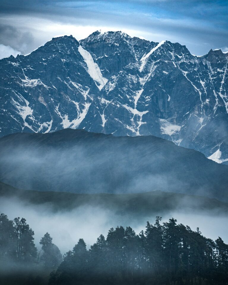
The ridge is easy to spot from Karen: rounded summits topped with white wind turbines. The western slopes fall more than 1,000 m to the Rift Valley floor, and the eastern side looks over Nairobi National Park to the city skyline. That double view makes the Ngong Hills hike a favourite near the capital.
How do you get to Ngong Hills by matatu?
Matatus to Ngong town leave from the Railways terminus in Nairobi CBD; route 111 is the one most people heading for a Ngong Hills hike use, but confirm with the conductor. From Ngong town, walk or take a boda boda to Ngong Police Station, near the Kenya Forest Service office.
To get home after a one-way Ngong Hills hike, catch a matatu or boda boda from Kona Baridi down to Kiserian and change there for town. Groups with two cars can leave one at Kona Baridi.
Can you drive and park?
Yes. Drive along Ngong Road through Dagoretti Corner and Karen to Ngong town, then follow signs to the forest station. There is parking near the gate and more below the wind turbines. Arrive before 8am for a quiet start.
The Ngong Hills Hike, Peak by Peak
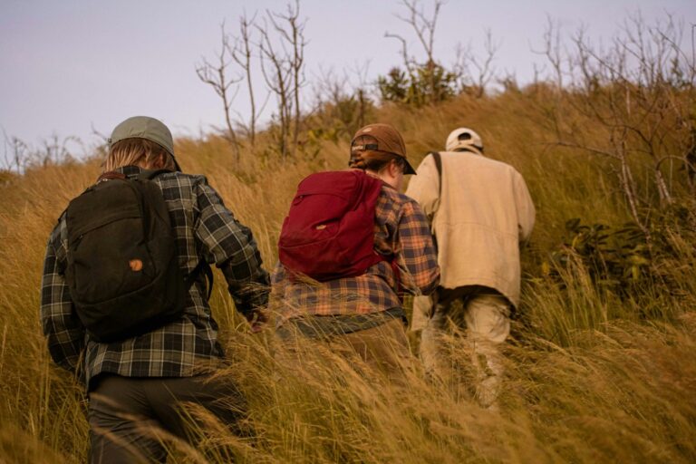
The route follows the crest of the ridge from north to south. The first stretch climbs on a dirt road past radio masts, then the path rolls over one rounded peak after another, with short, steep pulls up and knee-testing drops between them.
Hikers usually count seven peaks between the gate and Kona Baridi, although the number depends on what you call a summit. The first two give the best views of the turbines and the city. The middle section, including the highest point at about 2,460 m, feels more remote, with patches of forest and grassland on the eastern flank.
Buffalo live in the reserve and are sometimes seen around the fourth hill, along with colobus and vervet monkeys and baboons, so give any buffalo a wide berth. If you only want a taste of the ridge, a shorter Ngong Hills hike to the first two or three peaks and back takes 3-4 hours.
| Trail stat | Ngong Hills ridge traverse |
|---|---|
| Start | Kenya Forest Service gate near Ngong Police Station, about 1,961 m |
| Finish | Kona Baridi, southern end of the ridge |
| Distance | About 11 km one way; around 22 km out and back |
| Highest point | About 2,460 m |
| Time | 4-5 hours one way; 3-4 hours for a short out-and-back |
| Difficulty | Moderate: repeated steep climbs and descents, strong wind |
| Shade and water | Very little shade and no reliable water on the ridge |
How hard is the Ngong Hills hike for a beginner?
A reasonably active beginner can finish the full traverse. The path is clear and needs no scrambling, but the climbs come one after another and the steep descents tire thighs and knees.
If two hours is your longest walk so far, try the short out-and-back or one of our day hikes near Nairobi for beginners first. Fitter walkers are usually ready for the Mt Longonot crater rim next.

When Is the Best Time to Hike Ngong Hills?
The best months for the Ngong Hills hike are the drier spells, roughly January to February and June to September. The long rains fall around March to May and the short rains around October to December, when the red soil on the steep sections turns slippery.
Time of day matters as much as season. Mist often sits on the ridge at 7am and burns off by mid-morning, and by early afternoon the sun is strong and the wind gusty. Be on the trail by 8am and off the ridge by mid-afternoon, especially in the short rains, when storms build after lunch.
June to August brings grey, chilly mornings, so pack a light fleece for an Ngong Hills hike in those months. For wet-weather advice, read our notes on hiking in the rain in Kenya.
Fees, Rules and Safety on the Ridge
Kenya Forest Service manages the reserve and collects an entry fee at its office near Ngong Police Station or at the barrier on the trail. Rates change, so confirm the current charge before your Ngong Hills hike with the Kenya Forest Service before you go, and carry M-Pesa as well as some cash.
Is the Ngong Hills hike safe?
Ngong Hills is busy and generally relaxed on weekend mornings, when families, joggers and hiking groups share the path. Muggings of small groups have been reported in past years, though, so take sensible precautions rather than walking alone.
- Walk in a group and stay together on the quieter southern half.
- Ask KFS at the gate about a guide or ranger escort, offered for an extra fee.
- Start by 8am and be off the ridge by about 3pm.
- Keep phones and cash out of sight, and leave expensive jewellery at home.
- Share your route and expected finish time with someone in Nairobi.
- Keep a safe distance from buffalo, and turn back if one is on the path.
Wind is the other hazard on any Ngong Hills hike. Gusts on the higher summits can whip a hat into the valley, so tighten straps before each exposed section.
What to Wear and Pack for the Ngong Hills Hike
Pack for sun, wind and rain on the same day. The ridge has almost no shade, no water points and a cool breeze that hides how much sun you get above 2,000 m.
Footwear matters most on a Ngong Hills hike. Trail shoes with deep lugs are enough in the dry months, but in the rainy seasons the red clay on the descents calls for boots with a firm, grippy sole, such as the Quechua MH100 hiking boots. Pair them with merino wool hiking socks, which handle the long downhill sections without the hot spots that cotton socks cause.
Carry at least 2 litres of water per person, and 3 litres on hot days. A 3L hydration backpack lets you sip without stopping in the wind, while a 28L day backpack fits a fleece, rain layer and lunch. Add a wide-brim sun hat with a chin strap; hats without one rarely survive the higher peaks.
Much of our stock is quality thrifted gear, plus some new items, which keeps good boots, packs and layers affordable. Browse online or try things on at our Thika Road gear shop at Mountain Mall, 3rd Floor, Shop D39 (Monday-Friday 8:30am-6:00pm, Saturday 9:00am-2:00pm). For a full kit list, see what to wear hiking in Kenya.
Gear up for your next hike
Shop quality hiking and outdoor gear at great prices — from socks and gloves to hats, balaclavas and camping fuel. Everything you need for Kenya’s trails, delivered fast.
Ridge-Day Checklist
- Water: 2-3 litres each; nothing to refill on the ridge.
- Sun: hat with a chin strap, sunglasses and SPF 30+ sunscreen.
- Wind and rain: a light fleece plus a rain jacket or poncho in October-December and March-May.
- Feet: lugged trail shoes or boots, broken in, with wool-blend socks.
- Money: M-Pesa and small notes for the KFS fee, the boda boda and the matatu home.
Which Ngong Hills Hike Plan Suits Your Group?
Mixed-ability groups do best with an out-and-back to the second or third peak, finishing near the car. Fitter groups usually prefer the full one-way Ngong Hills hike to Kona Baridi, with transport arranged at the far end.
On a clear morning you see Nairobi’s towers across the national park to the east, and the Rift Valley floor stretching towards Mt Olorgesailie to the west. Once the ridge is in your legs, our round-up of the best hikes in Kenya suggests where to go next.

Ready to hit the trail?
Join one of our upcoming guided hikes — from beginner-friendly day hikes to longer treks across Kenya’s best routes.
Frequently Asked Questions
How long does the Ngong Hills hike take?
The Ngong Hills hike takes most groups 4-5 hours one way from the Kenya Forest Service gate near Ngong town to Kona Baridi, a distance of about 11 km. Walking back to the gate roughly doubles that. A shorter out-and-back to the first two or three peaks takes about 3-4 hours, which suits beginners and families with older children.
How much does it cost to hike Ngong Hills?
Ngong Hills charges an entry fee collected by the Kenya Forest Service, with different rates for citizens, residents and non-residents, and extra charges for a guide or ranger escort. Fees are reviewed from time to time, so confirm the current amount with KFS before your trip. Budget separately for the matatu, the boda boda to the gate and the ride home from Kona Baridi.
Is the Ngong Hills hike safe for a small group?
Small groups do walk Ngong Hills safely every weekend, but the reserve has a history of muggings on quieter sections, so it is wise to take precautions. Start early, stay together, keep valuables hidden and ask KFS about a ranger or guide at the gate. Avoid being on the ridge late in the afternoon, and give buffalo plenty of space.
How many hills does Ngong Hills have?
Most hikers say the Ngong Hills ridge has seven peaks between the northern gate and Kona Baridi, though the count depends on which bumps you treat as summits. From Karen and the film Out of Africa, four rounded knuckles stand out against the sky. The highest point along the ridge is about 2,460 m above sea level.
Can I hike Ngong Hills in the rainy season?
Ngong Hills can be hiked in the rainy season, but the red clay becomes very slippery on the steep descents, and afternoon storms bring wind, cold and lightning risk on the exposed ridge. Wear boots with deep lugs, carry a rain jacket or poncho, start at first light and turn back early if dark clouds build over the Rift Valley.
Final Thoughts
Few walks this close to the city put the Rift Valley on one side and Nairobi on the other. Start at the KFS gate early, carry more water than 11 km seems to need and sort your ride home from Kona Baridi first, and the Ngong Hills hike becomes a full, satisfying day for most reasonably fit people.
Pick a dry Saturday, gather two or three friends and get your boots, socks and sun hat sorted this week, so the only thing left to think about on the ridge is the view.
Not sure your shoes will grip on the Ngong descents?
Our team can help you choose the right gear, answer your hiking questions and get your order dispatched quickly. Message us for a quick, straight answer.